Surveying Plats and Maps
Smoky Mountain Land Surveying, located in Franklin, NC, provides many different surveying services throughout Western North Carolina. We have provided a few examples of surveying maps and plats below:
Click plat to view ALTA survey PDF:

ALTA Survey for 808 West, LLC by Smoky Mountain Land Surveying – Franklin, NC
Click plat to view ALTA Survey PDF:
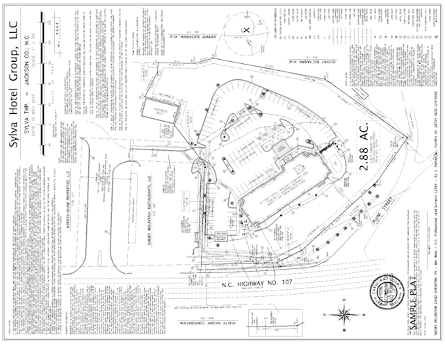
ALTA Survey for Sylva Hotel Group, LLC by Smoky Mountain Land Surveying – Franklin, NC
Click plat to view AS-BUILT survey PDF:
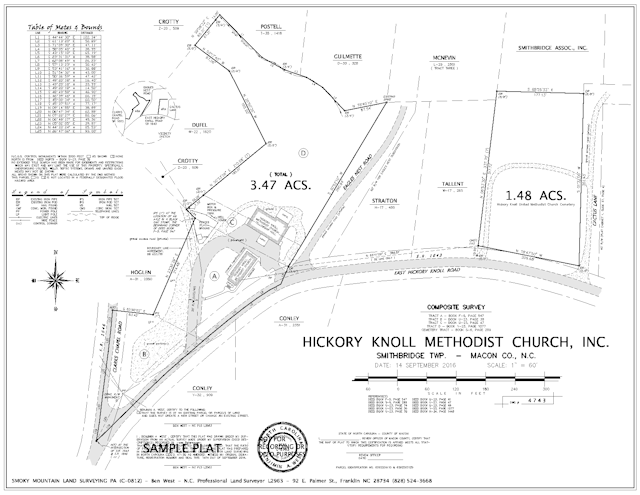
As-built survey for Hickory Knoll Methodist Church, Inc. by Smoky Mountain Land Surveying – Franklin, NC
Click plat to view BOUNDARY survey PDF:
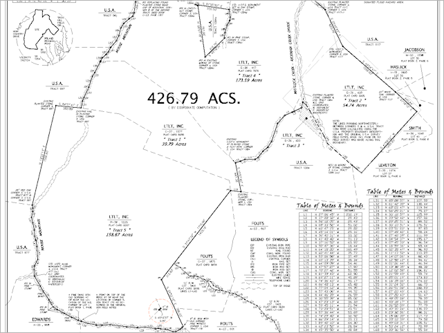
Boundary Survey for The Land Trust for Little Tennessee, Inc. by Smoky Mountain Land Surveying – Franklin, NC
Click plat to view BOUNDARY survey PDF:
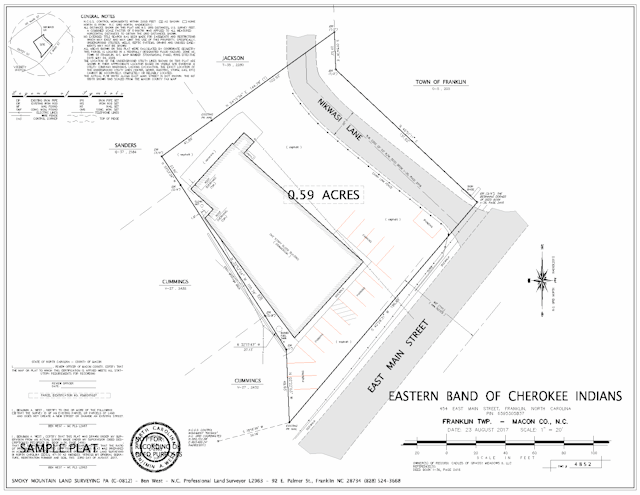
Boundary Survey for Eastern Band of Cherokee Indians by Smoky Mountain Land Surveying – Franklin, NC
Click plat to view Location survey PDF:
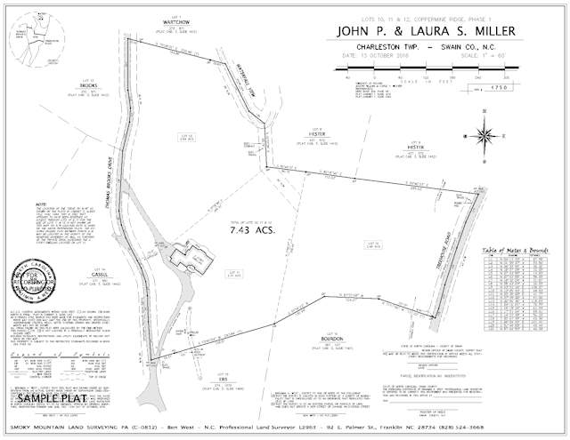
Location Survey for John P. & Laura S. Miller by Smoky Mountain Land Surveying – Franklin, NC
Click plat to view SUBDIVISION survey PDF:
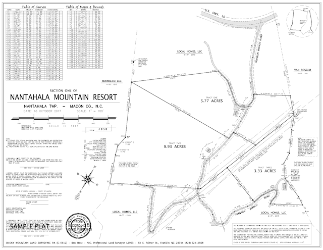
Subdivison Survey for Nantahala Mountain Resort by Smoky Mountain Land Surveying – Franklin, NC
Learn about Subdivision Surveys
Click plat to view TOPOGRAPHIC survey PDF:
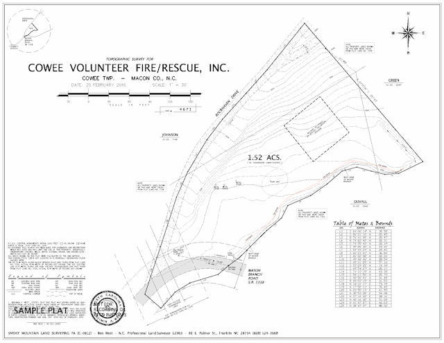
Topographic Survey for Cowee Volunteer Fire/Rescue, Inc. t by Smoky Mountain Land Surveying – Franklin, NC
You must be logged in to post a comment.